
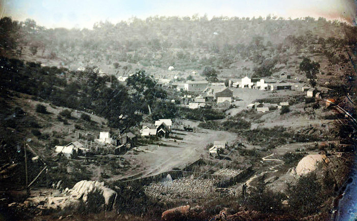

During the height of the gold rush Mormon Island was once a thriving gold mining camp. In its heyday, the town had 2500 residents (mostly Mormon), 4 hotels, 7 saloons, and 1 school.
-
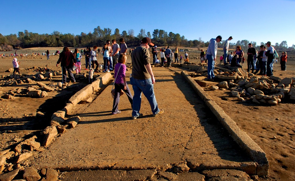
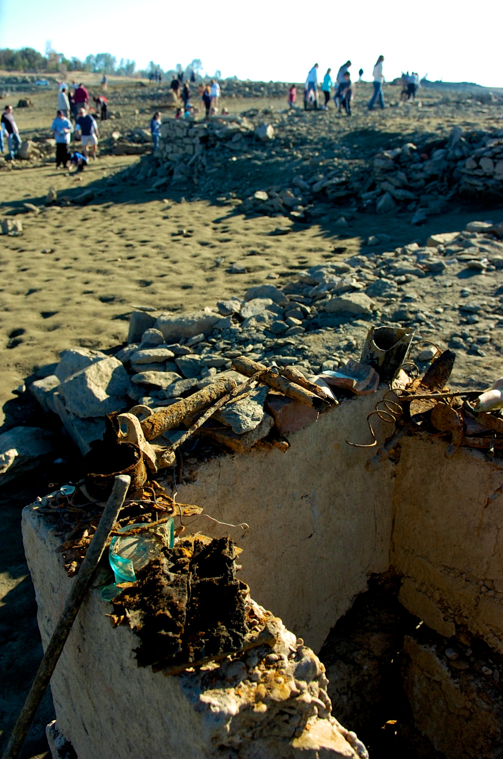
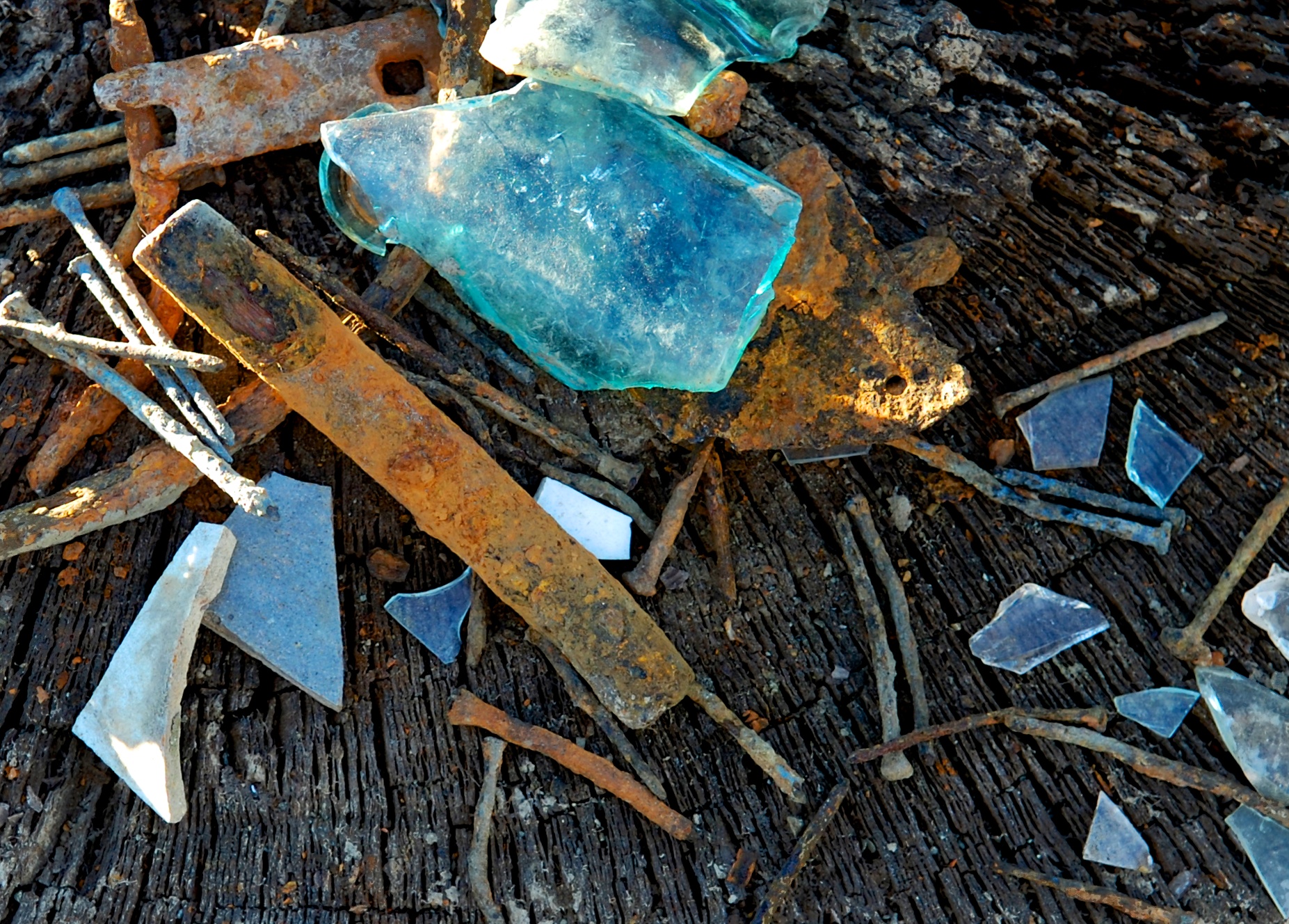
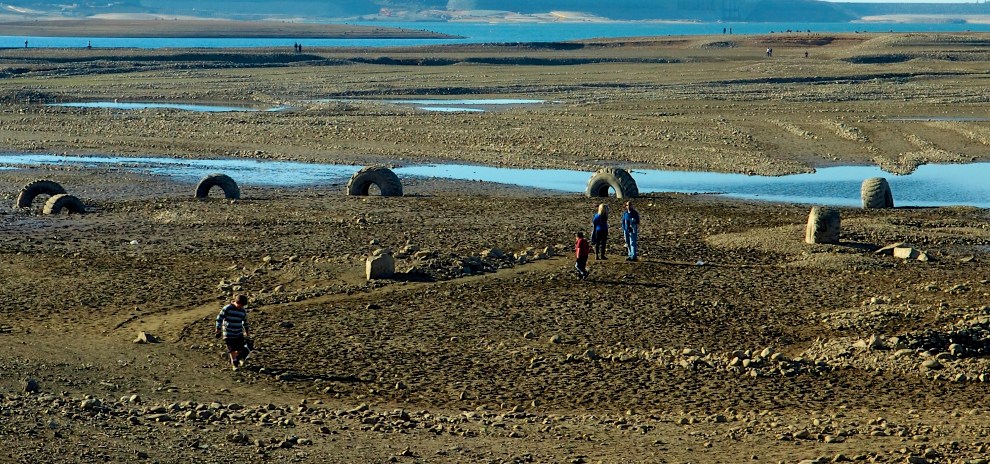
Exposed foundations and other artifacts draws hundreds of curious explorers. Photo: AmericanRiverWildlife.com

The town dwindled along with gold fever and by the 1950s there were no more than a few residents left. What was left of the town was eventually flooded in 1955 with the creation of Folsom Lake.
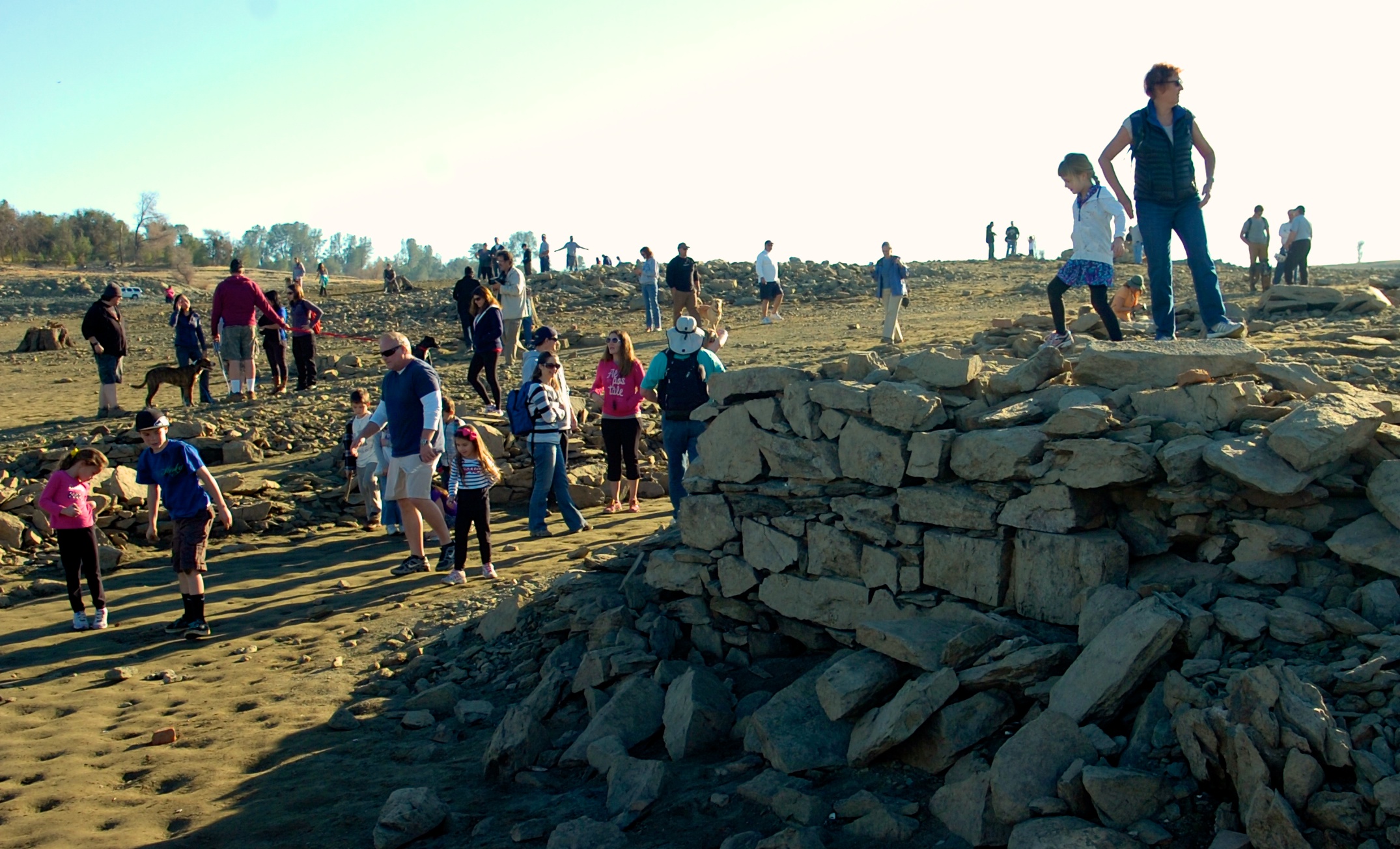
The only remnants of this town are sometimes visible during extreme drought years, as foundations of houses lie underwater.There is a relocation cemetery located south of the lake, where residents were moved before the lake was filled. A few unknown residents of Prairie City were also transported there when they were discovered during Intel’s onramp construction.
Mormon Island was also known at the time as Mormon Diggins, Mormon Diggings, and Lower Mines.
If you go:
- Everything you’ll see is state park property and it is illegal to remove it.
- There’s a parking fee at most access points. State park info here: http://www.parks.ca.gov/?page_id=500
- The Dyke 8 entrance off of East Natoma and Briggs Ranch gets you close to the water but not close to the artifacts.
- Brown’s Ravine is the most popular parking spot and offers a short hike to the ruins and remnants
- Wear proper shoes and clothing. The conditions range from steep, slippery slopes to wet muddy conditions.
- Bring water.