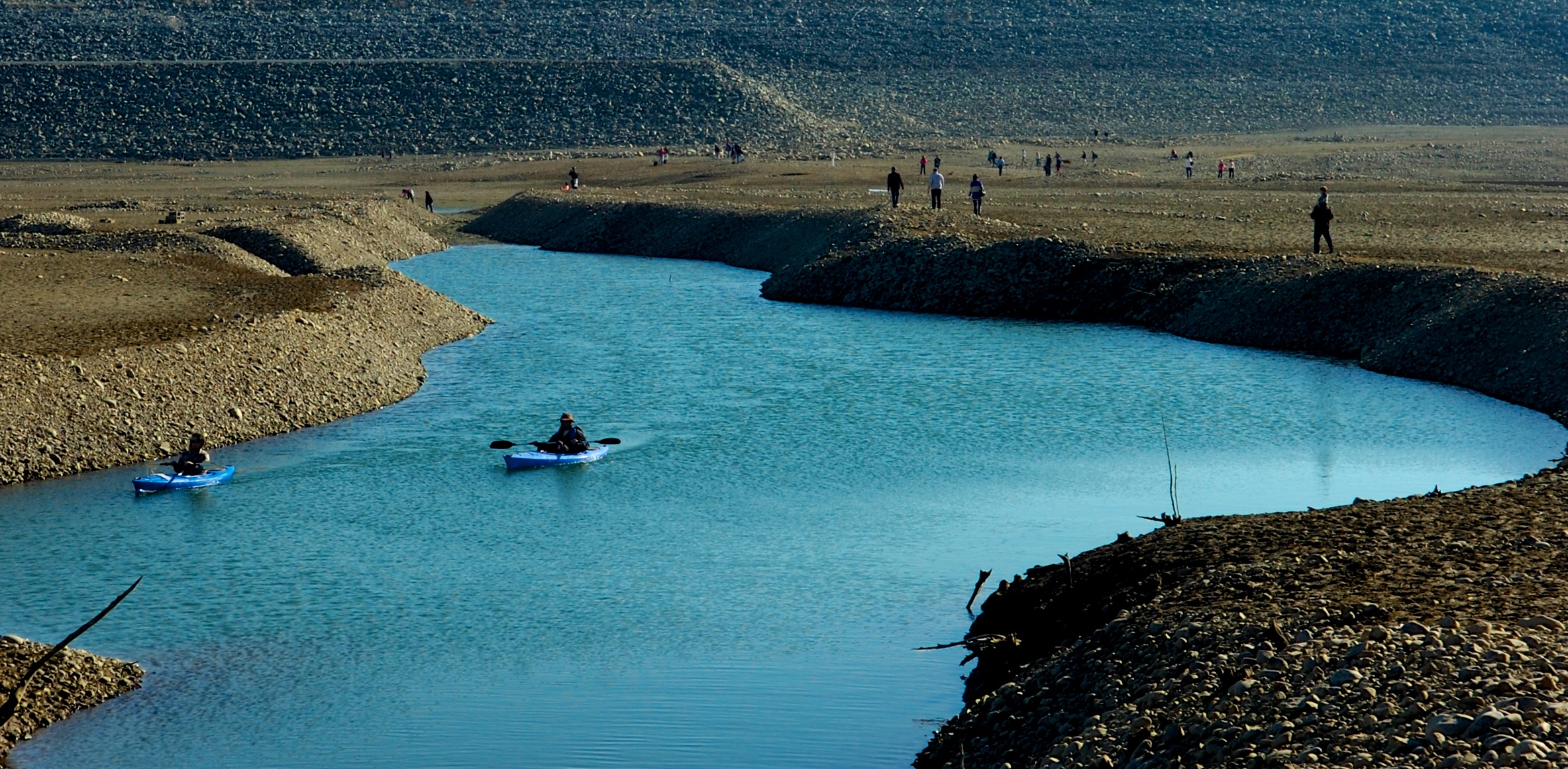
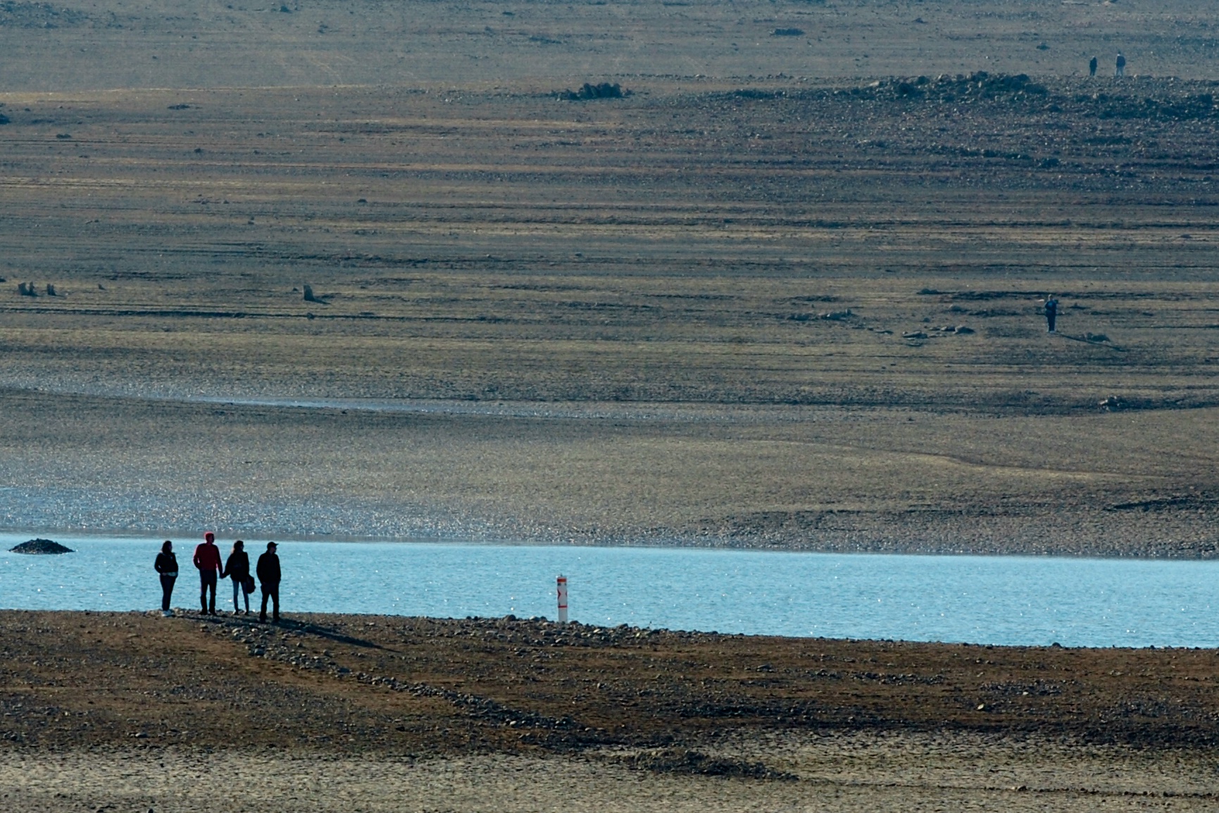
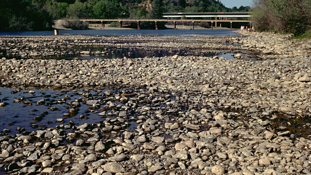
More Rangers For American River Parkway

Sacramento County has four new job postings for rangers. Chief Stan Lumsden says the four openings will make up half of the positions lost during the recent recession.

“They lost several rangers which eroded the ability to provide public safety out in the park. Now we’re hoping with the addition of these four rangers, we can enhance that safety,” says Lumsden.

Before the recession, the Sacramento Regional Parks system had 22 rangers. Today it has just 13.

Lumsden says the new rangers will increase safety and service along the parkway through a ranger stewardship program.

“I have rangers assigned to geographic areas. In other words, they more-or-less own their specific, respective pieces  of the park. I hope to enhance that program.”

The Sacramento Regional Parks system has 15,000 acres. In addition to the American River Parkway, rangers patrol other areas including Sherman Island, Hogback Island, Georgiana  Slough and the Rio Linda Bike trail.

After background checks and academy training, new rangers could be on the parkway by June.

From CapRadio.org >>>

Some Species In Delta Still At Risk From Water Diversion Tunnel Project

Despite a 34,000 page long environmental study, the California Department of Water Resources cannot say exactly what a massive water diversion and habitat restoration program will do to at least nine of fifty Northern California delta species.The irony is that the Sacramento/San Joaquin valley water restoration and conservation project was expected to help endangered species, according to a Dec. 18 Sacramento Bee article.

The giant water diversion project will cost $25 billion and will use three massive tunnels to divert water from the Sacramento River.

The Bay Delta Conservation Plan’s first complete draft was released to the public this week. It will be available for a 120 day public review, notice and comment period.

The environmental impact report was supposed to clear up any issues with affected species, like salmon, cranes, fish and more. There are actually 57 endangered species that might be affected.

The problem is with several “not determined” findings from the U.S. Fish and Wildlife Service and the National Fish and Marine Fisheries Service. These federal agencies are at odds with the State Department of Fish and Wildlife service, which finds a “less than significant” effect on the nine species.

The federal agencies say it is too early to make a final determination. The state appears to be in a rush for approval, but the only support for any conclusions comes from computer modeling.

In other words, until this unprecedented and massive habitat restoration and water diversion project is actually built and operating, no one knows for sure what will happen to individual species or their habitats.

More at Examiner.com >>>

In Other Watershed News: San Joaquin Valley Salmon Make Small Gains Against Tough Odds

With a flash of silver and pink, a male salmon signaled its arrival in a stretch of the Tuolumne River near La Grange.

It sought to fertilize eggs laid in the shallow stream bed gravel by a female that also had returned from a few years in the Pacific Ocean.

Chinook salmon spawning has been going on since September on San Joaquin Valley rivers. It’s a stirring sight for people who love nature, but important as well to farmers and other water users who could face cutbacks if the fish numbers stay low.

This year, at least, they are not doing too badly. Many of the spawning fish were born on the rivers in 2010 and 2011, when the water ran high, and they enjoyed healthy conditions at sea. They return to streams shrunken by drought, but well-timed reservoir releases have provided some of the flows they need.

“This is where they want to be,” said Gretchen Murphey, an environmental scientist for the California Department of Fish and Wildlife, during an early December visit to the La Grange stretch. “This is the habitat they’re looking for.”

As of Monday, 3,607 salmon had passed through a fish-counting device on their way to the Tuolumne’s spawning stretch in the low foothills, up from 2,152 a year earlier, and just 255 in 2009.

More at ModBee.com >>>

Read more here: http://www.modbee.com/2013/12/19/3097869/salmon-make-small-gains-against.html#storylink=cpy

Suspect sought after fires set along American River in Sacramento

Sacramento Fire Department investigators are searching for a suspect who is believed to have started several small fires this afternoon along the American River near Highway 160.

Assistant Chief Kim Iannucci said the first crew responded about 2:40 p.m. to a fire on the north side of the river near Northgate Boulevard. Firefighters arriving at the scene reported fires on the south side of the river as well, and a second crew was dispatched to the area near Richards Boulevard, Iannucci said.

The fires were largely contained by about 4 p.m., although crews continued to mop up hot spots.

From the SacBee.com >>>

Feds May Have Harmed Sacramento River Salmon

The federal agency that regulates water releases from the Shasta Dam in Northern California drastically cut those releases in November, and one fisheries group is afraid that the move could have killed millions of eggs laid by fall-run chinook salmon in the Sacramento River below the dam.

According to the Golden Gate Salmon Association (GGSA), the U.S. Bureau of Reclamation (BuRec) cut releases from Lake Shasta from 6,000 cubic feet per second (CFS) to 3,750 CFS between November 1 and 25. This caused river levels downstream to drop dramatically, which means that any salmon eggs laid in parts of the river that died up will almost certainly be lost.

This isn’t the first year BuRec has cut November water releases from the dam, and those cuts have hurt salmon in previous years. As many as 15 percent of the Sacramento river’s fall-run eggs were lost after a similar move in 2012, and almost a quarter of the run’s 2011 eggs were killed the same way, according to GGSA.

More at KCET.org >>>

Why do Pacific Salmon Die After Spawning?

The upriver salmon run is one of nature’s great migrations. Each year mature salmon make the long journey back to their natal river to reproduce, just once. For the five species of Pacific salmon (Chinook, chum, coho, pink, and sockeye), this arduous journey is a race against the clock that ends in a fleeting romance and ultimately death.

The answer to why they die, it turns out, hinges on a problem every animal on Earth has had to solve.

“Every kind of organism has evolved to solve the problem of balancing how much energy to put into surviving to first reproduction and how much energy to put into surviving to reproduce repeatedly,” said Steve Lindley, the director of NOAA’s Fisheries Ecology Division.

“Salmon are one of the extreme cases where they put everything into reproducing just once, and then getting old and dying almost immediately thereafter (a common strategy among insects but much less so for vertebrates).”

The reason for this, Lindley suggested, has to do with the difficult upriver migration salmon make back to their own spawning location. Flipping their bodies in the air and hurling themselves against the downward flowing water is no easy feat and one that is energetically exhausting. Because of this, salmon must fully develop in the ocean and build up fat reserves. Once they enter the river there is little food to eat and they stop investing in the maintenance of their bodies.

“The proximate reasons have to do with DNA switches,” Lindley said. “Essentially many of the activities that operate in immature salmon to allow them to maintain their health, grow and mature are turned off after maturation, and without maintenance they pretty rapidly ‘fall apart’.”

An alternative for these salmon species would be to spend more time in the ocean, accumulating food and energy so they are then able to migrate back after spawning. But this increases their risk of dying before getting the chance to spawn and for Pacific salmon, this is a risk too great.

From BayNature.org >>>

Prescribed Burns in Tahoe National Forest

The Tahoe National Forest American River Ranger District has begun its fall prescribed burn program. Fall and winter burning will include roadside hand piles, large machine piles, and up to 450 acres of underburning.

The exact timing of burns depends on specific fuel moisture and weather requirements designed to reduce the possibility of escape, manage smoke concerns, and ensure the best possible conditions for fuel consumption.

Burning is scheduled to occur in the following areas: Foresthill Divide; Humbug Ridge; the Sailor Point area off the Texas Hill Road; and Last Chance. Because smoke may cause diminished visibility during burning operations, forest visitors should stay alert for signs warning of prescribed burning or smoke obscuring the road. People traveling through a prescribed burn area should turn on headlights and be aware that burn personnel may be working along the road.

District fire managers work with the Redding Fire Weather Center and Placer County Air Pollution Control District to plan the prescribed burns to minimize smoke impacts to communities. However, some smoke may settle into the valleys during the evenings and mornings until atmospheric conditions allow for smoke dispersal.

For questions concerning the fall burn program, please contact fire management staff at the American River Ranger Station in Foresthill by calling (530) 367-2224. Daily updates can also be obtained at (530) 367-2224 as the burn program progresses.

For more Tahoe National Forest information, go to http://www.fs.usda.gov/main/tahoe/home.


Volunteers sought to repair trails damaged by American fire

Tahoe National Forest officials have reopened parts of two popular trails damaged in August by the American fire and are seeking volunteers to help rehabilitate the remaining trail segments.

The Western States Trail is open between Michigan Bluff and Deadwood Cemetery, and OHV Trail Loop 6, also known as Forest Service Trail 11E44, is open west of Deadwood Ridge Road.

The entire fire area, including all trails and roads within it, will remain closed for public safety until May 1, said Gwen Ernst-Ulrich, forest spokeswoman.

The fire, northeast of Foresthill in Placer County, burned 27,440 acres within the forest’s American River Ranger District and surrounding properties, including three historic buildings at the Pacific Slab mine.

Eighteen of the 25 miles of the Western States Trail damaged by the fire have been rehabilitated, Ernst-Ulrich said, and efforts are underway to winterize the remaining seven miles to minimize erosion.

Since 1974, the trail has been the site each June of the internationally known Western States 100-Mile Endurance Run from Squaw Valley to Auburn and, in August, the Tevis Cup Endurance Ride.

The remaining damaged seven-mile segment, between Last Chance and Deadwood, is listed on the National Register of Historic Places. It includes two fire-damaged bridges across the northern portion of the middle fork of the American River canyon.

“The (ranger) district is looking at alternate routes for these events if the swinging bridge that crosses the river is not able to be used in time,” Ernst-Ulrich said. “Thousands of other recreationists use this popular trail annually.”

More at SacBee.com >>>

Forest service officials assess trails in American Fire area

American_Fire

Now that fire activity within the American Fire area has diminished, Tahoe National Forest officials have assessed conditions on two popular trails: the Western States Trail and OHV Trail Loop 6, also known as Forest Service Trail 11E44 (Loop 6).

The Western States Trail between Michigan Bluff and Deadwood Cemetery is open, and Loop 6 is open west of Deadwood Ridge Road. The entire fire area, including all roads and trails, is closed under Forest Order 17-13-08, which is in effect until May 1, 2014.

Therefore, the Western States Trail and Loop 6 within the fire area east of Deadwood Ridge Road remain closed. These trails will be returned to acceptable standards before being considered safe for recreationists.

The American Fire affected approximately 25 miles of the trail. To date, roughly 18 of those miles have undergone rehabilitation through fire suppression and/or burned area emergency rehabilitation efforts.

More at TheUnion.com >>>

1964 Highway 49 Bridge Rubble Remains A Cleanup Quandary

HWy49Bridge

By most accounts, the Highway 49 bridge blowout of December 1964 was spectacular.

The Dec. 23, 1964, bridge washout put traffic on the Mountain Quarries Railroad Bridge for four months, and a new Highway 49 bridge was in place by spring of 1965. That year was also when the Auburn dam project was authorized by Congress. Though the dam was never built, the possibility that it would be constructed left the option of doing nothing open. The downstream rubble and steel the washout left behind would soon be under hundreds of feet of water.

Almost 50 years later, the dam has yet to be built and the remains of the bridge have yet to be cleared away – leaving a quandary for several levels of government, as well as environmentalists advocating greater use of the Auburn State Recreation Area as a park.

During fall days like Wednesday, when the American River flows are down to their lowest levels of the year, the mangled steel can be seen clearly in the river bed, some of the pieces poking up above the water line. The broken concrete – giant gray chunks weighing several tons – litters the canyon shoreline.

Elias Silver of the Lake Tahoe area was at the shoreline skipping stones with friends as their dogs romped in the calm, meandering waters at the confluence below the newer Highway 49 bridge.

“It’s definitely noticeable,” Silver said. “With all the state budget problems, it would be expensive to fish out. It’s not a small project.”

More at FolsomTelegraph.com >>>